Home
2024 BMC Summer Safari!!!
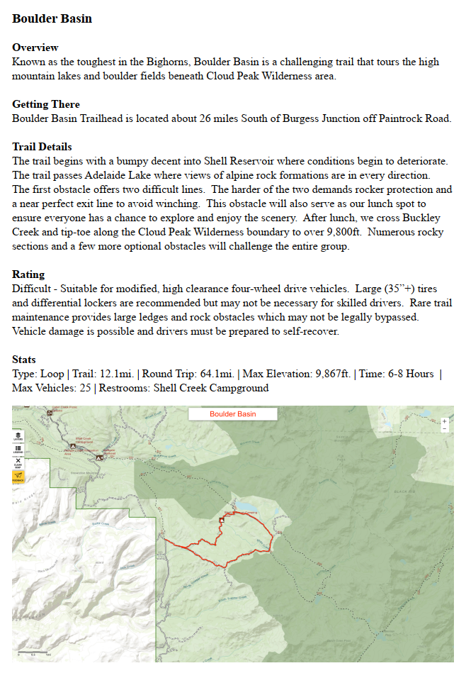
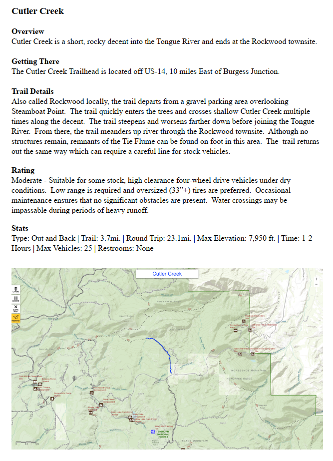
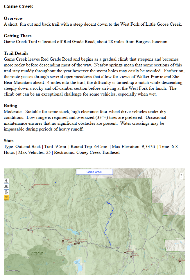
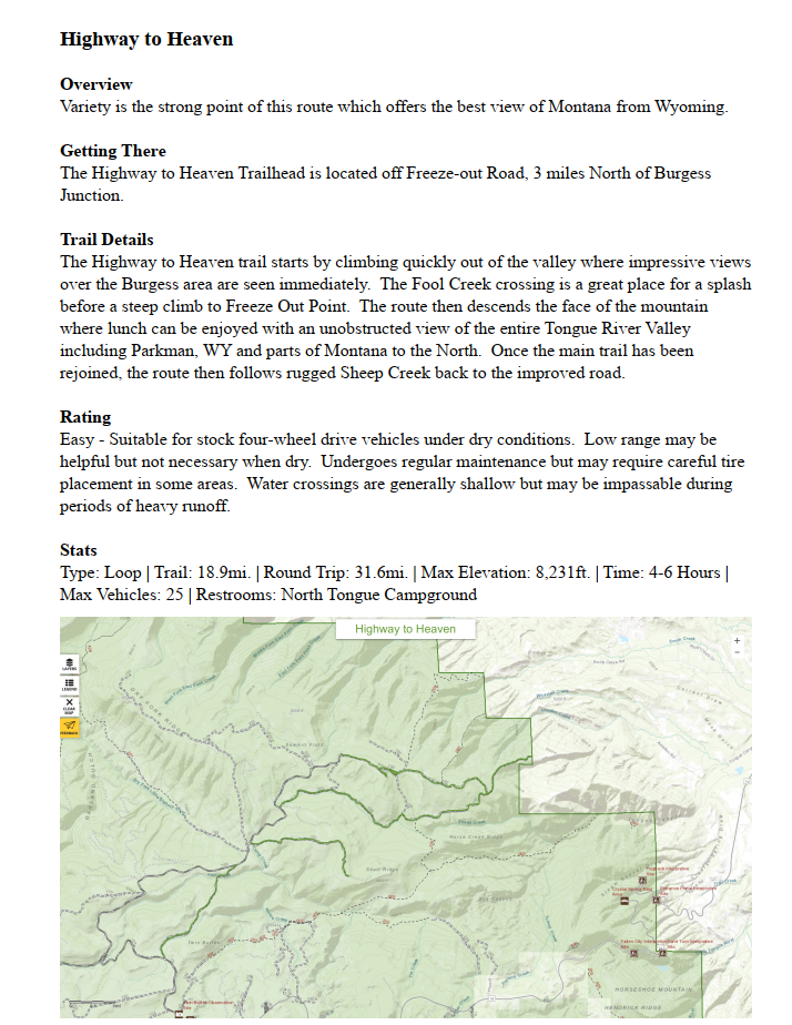
Safari Trails
Safari Registration
Event Lodging
BMC Club Members
About
Links
Contact
Vendor Registration
Expedition Upgrade
bmc_trails.pdf
File Size:
123099 kb
File Type:
pdf
Download File
Home
2024 BMC Summer Safari!!!
Safari Trails
Safari Registration
Event Lodging
BMC Club Members
About
Links
Contact
Vendor Registration
Expedition Upgrade